warning
This auction is archived, you cannot bid or buy items from this auction!
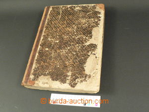
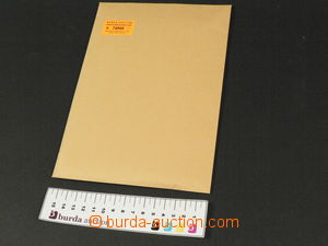
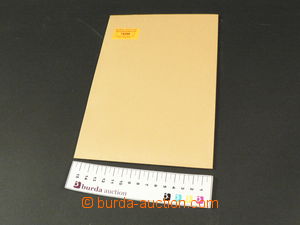
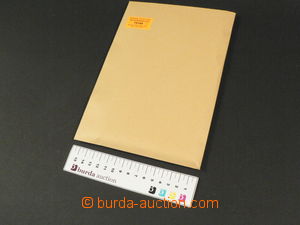
1850 Meyer's Kriegs- and Friedens-Atlas, 148 maps, format 25x34cm, contains map/-s Europe, Russia, Turkey and Asia, missing Africa, Australia, America, total 90 maps, light stains, very abraded folder, else preserved U:Z
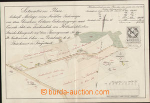
1860 situation plan Rotschildova colliery Doubrava-Orlová (Dombrau-Orlau) with zakreslenou new way, with revenue 15 Kreuzer, service postmark Olmütz, format A4, cross fold U:A4
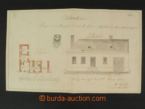
1867 technical documentation to/at building house No.45 in/at bottom Kounicích, Czech text, revenue 15 Kreuzer, green print sealing-stick, crosswise folds, warped paper U:A3s|
1884 Landshut, Austro-Hungarian map with part of Slovak territory - Záhorie, underglued plátnem, folded, preserved U:A5
1912 comp. 2 pcs of maps in/at měřítku 1:450.000, traveller's map Moravia and Silesia with rozdělením according to court obvodů, drew Wagner, format 76x55cm, light stains in margins, and road map Moravia and Silesia, format 75x60cm, good condition U:O5
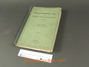
1912 VOJENSKO HISTORICKÝ ATLAS - Trial military campaign 1792-1912, 58 color maps with drawings fights and campaign, written in German, good condition U:Z
1915 Touren-Karte für Automobil- and Radfahrer, Wien, Krems, traveller's folding map, scale 1:300.000, format 50x45cm, stain on krycím sheet U:O5
1918 přehledná map Russian bojišť, eastern sheet, issued K.u.K.. militär-geogr. Institute, Wien, scale 1:750.000, format 70x95cm, underglued by fabric, folded into pocket size, partially torn fabric outside paper map/-s U:O5
1920 comp. 2 pcs of maps in/at měřítku 1:500.000, Fastr's road map, Bohemia, format 80x70cm, hole by/on/at town Chemnitz, and Fastr's road map, Bohemia, short tear in folds U:O5
1920 comp. 8 pcs of maps, battle field WWI.., West and eastern front, standard quality U:O4
1920 tourist map Krkonoše, scale 1:100.000, format 70x51cm, incl. original envelope/-s, good condition U:O5
1924 Ottův zeměpisný atlas, whole world, 44 main maps and 99 side maps, detailed list, large format 29x44cm, folder slightly abraded, inside well in good condition and clear, on/for Sběrateli offered after/behind 2200CZK, in addition Neubertova world map big format in/at very used status U:K
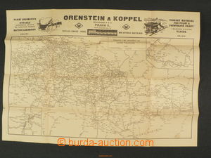
1929 railway and state car track Czechoslovakia and graphics znázornění jízního order rychlíků, format 59x40cm, advertising, short tear in folds U:A5
1930 LITOVEL - managing district, map 1:100000, folded, good condition U:A4
1930 map battle field German - French, scale 1:1.500.000, publ. Neubert, Smíchov, format 76x90cm, short tear in fold U:O5
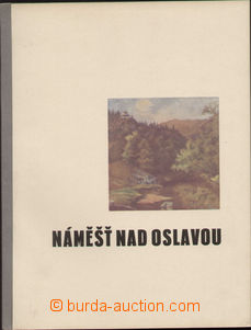
1930 Náměšť n./O., promotional publication town and his surroundings, a lot of historical date, photos, local data, good condition U:O4
1930 nationality map Czechoslovakia, scale 1:750.000, 2. issue, format 125x62cm, according to sčítání people from 1. December 1930, in color odlišené nationality, short tear in fold, otherwise good condition, very interesting document U:O4
1930 road map Carpathian Ruthenia, scale 1:400.000, format 79x59cm, very good condition, map from 5-dílného set Neubert, also with 2 map/-s Bohemia sever and jih U:O5
1933 ŽILINA, TRENČÍN, map special map, 1:200000, folded, light torn, underglued U:A4
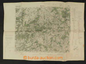
1936 BEROUN, HOŘOVICE - map special map, military, 1:75000, folded U:A4
1938 BENEŠOV, BRDY, map special map military, 1:75000, folded, in margin slightly torn U:A4
1938 JIHLAVA and surroundings, map special map, 1:200000, folded U:A4
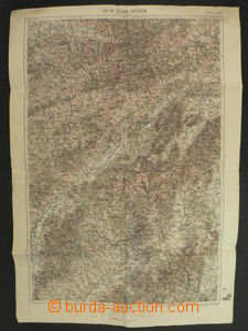
1939 fyzická map Slovakia and Hungary after/around anektování part/-s territory Slovakia and Carpathian Ruthenia, scale 1:750.000, format 100x70cm, good condition U:O4
1943 political map Hungary - západ, scale 1:500.000, format 85x103cm, good condition U:O4
1943 road network Slovakia, scale 1:500.000, format 84x60cm, advertising, light stains, partially torn in folds, stains U:O4